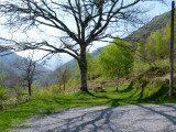
Promenades et Randos faciles
Le circuit patrimoine des mines de Baburet
Contact
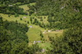
LOUVIE-SOUBIRON
- Distance :
- 2.8 km
- Vertical rise :
- Dénivelé positif cumulé 160
- Temps de parcours :
- 1h30
- Level of difficulty :
- Très facile
- Mode of travel :
- à pied
Presentation
This loop proposes to take a trip back in time, when iron mines were exploited on the territory of Eschartès, a district of the commune of Louvie-Soubiron located at 6 hours walk from the village!
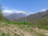
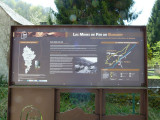
A route marked out with fascinating information on the history of this exploitation, stopped in 1962.
Details
- Type of route :
- Pédestre
Download
Itinéraire
 Departure/Arrival
 Point of interest


Pics
Pics